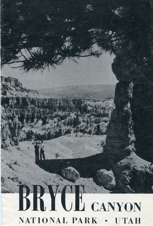
Bryce Canyon
NATIONAL PARK Utah
UNITED STATES DEPARTMENT OF THE INTERIOR
Oscar L. Chapman, Secretary
NATIONAL PARK SERVICE
Conrad L. Wirth, Director
2
Contents
- Panorama of Bryce Canyon Cover
- Geology of Bryce Canyon National Park 4
- How to Reach the Park 8
- Roads and Trails 8
- Administration 10
- Naturalist Services 10
- Museum 10
- Free Public Campgrounds 10
- Accommodations 10
- Transportation 12
- Saddle Horses 12
- Post Office and Communication Service 13
- Miscellaneous Services 13
- Cedar Breaks National Monument 15
Historic Events
| 1866 | Capt. James Andrus in command of a military expedition from St. George, Utah, crossed the Paria River a few miles south of Bryce Canyon. |
| 1872 | A. H. Thompson, geographer of the Powell Survey, sketched the topography of the Pink Cliffs eastward to Rainbow Point and ascended Table Cliffs. Lt. W. L. Marshall, topographer, and G. K. Gilbert and E. E. Howell of the Wheeler Survey mapped, described, and illustrated for the first time the features of the park north of Campbell Canyon. |
| 1874-76 | Scattered settlements established in the Upper Paria Valley. Ebenezer Bryce, for whom the park is named, ranged cattle in the area. The region that includes Bryce Canyon National Park studied by Capt. C. E. Dutton. View from Sunset Point described (1876) by T. C. Bailey, Deputy U. S. Surveyor. |
| 1877 | Cannonville and Henrieville founded. |
| 1905 | The Paunsaugunt Plateau, which includes the park, set aside as Powell National Forest. |
| 1923 | Bryce Canyon National Monument established by Presidential proclamation. |
| 1924 | Act of Congress authorized the establishment of Utah National Park, subject to extinguishment of private land titles. |
| 1928 | Name changed from Utah National Park to Bryce Canyon National Park; park established. |
3
Bryce CanyonNational Park
...